
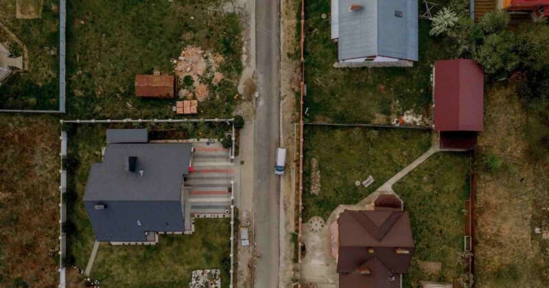
Oklahoma lawmakers are considering a bill that would let officials use aerial photos and satellite images to assess property taxes instead of visiting properties in person.
The measure, which is moving through the Oklahoma Legislature, would allow county assessors to use aerial photography and satellite imagery to evaluate properties and determine their taxable value. According to a report by Oklahoma-based news outlet KTULA, the proposal could change how property values are assessed and affect how much homeowners pay in taxes.
Senate Bill 2143 would permit assessors to rely on “digital visual technology on aerial images or satellite” to identify changes to properties, rather than depending only on in-person inspections. The bill specifies that the images would be taken from high-altitude aircraft, not drones.
“These are aircraft in above excess of 10,000 feet. They fall under the FAA privacy rules,” Oklahoma State Representative Mark Tedford tells KTULA.
Supporters say the bill is intended to make the assessment process more efficient. They argue that using aerial and satellite imagery could speed up evaluations and reduce costs, particularly by limiting the need for assessors to travel to properties.
“We have 38 appraisers who may be required at any time to drive to each property to inspect for changes,” Mark Liotta, Chief Deputy at the Tulsa County Assessor’s Office, tells KTULA.”That’s mileage and time and all that costs money.”
However, critics of Senate Bill 2143 say aerial photography could lead to inaccurate property valuations, especially in rural areas where aerial images may be less detailed. They warn this could result in unfair tax increases for some homeowners.
The bill has passed a Senate committee and is now headed to the House for further consideration. If it becomes law, assessors say they could begin using the technology immediately because counties already have access to the images.
Both supporters and critics of the bill agree that protections should be in place if aerial photographs or related data are incorrect.
The proposal comes as aerial photographs is increasingly used in other areas of property assessment. In recent years, there have been reports that home insurance companies are secretly taking photos of private residences using drones, surveillance balloons, and manned aircraft to assess risk and justify canceling policies. Major insurers across the United States are using aerial images as a low-cost way to evaluate properties, and reports suggest that many buildings are photographed without the owner’s knowledge. In one reported case, a woman in Modesto, California, who had spent hundreds of thousands of dollars on home renovations, had her insurance canceled after a drone flight over her home led the company to cite unsanitary conditions.
Image credits: Header photo licensed via Depositphotos.


 English (US) ·