
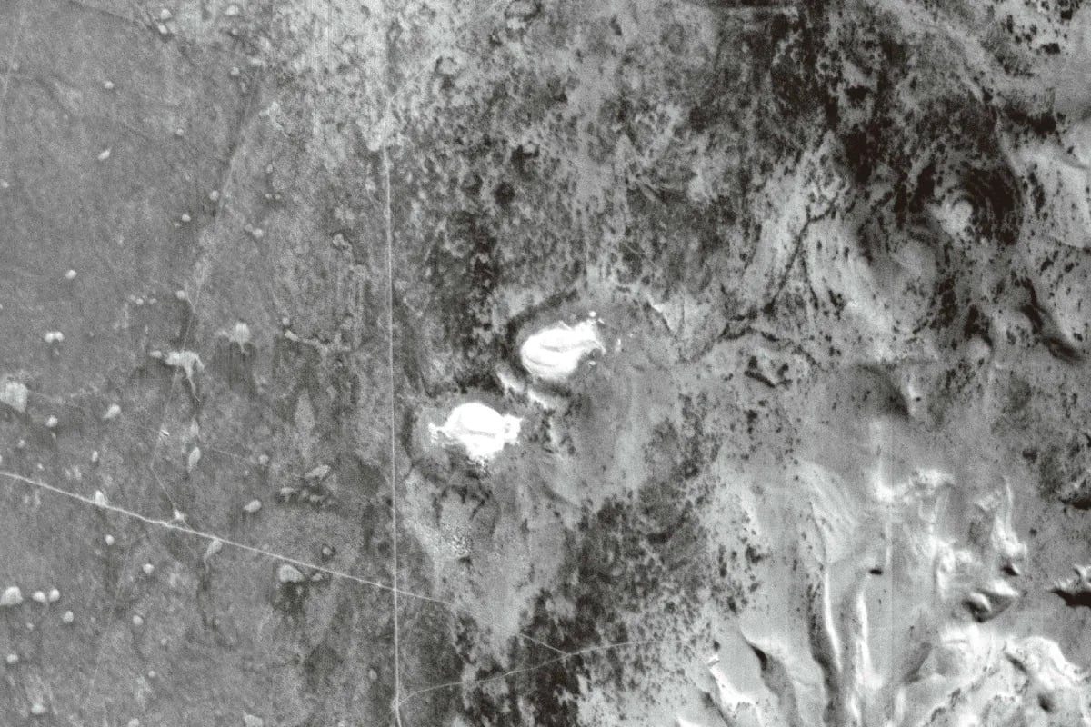
 The CubeSat zoomed in on Camano Island, Washington, as close as one square kilometer (0.6 miles).
ArkEdge Space, a Japanese startup, says it has captured what might be the highest quality images of Earth taken by a CubeSat, a small satellite.
The optical observation CubeSat called ONGLAISAT is roughly the size of a small suitcase and can take 2.5 meter (8.2 feet) resolution images from 410 kilometers (255 miles) above the Earth’s surface. That means each pixel in the image captured by the satellite represents an area on the Earth’s surface that is 2.5 meters by 2.5 meters (8.2 feet by 8.2 feet).
ArkEdge Space, which built the satellite for Taiwan’s space agency TASA, says the pictures are “probably” the highest quality images of Earth taken by a CubeSat.
“The pictures are as clear as aerial photography (despite) being taken by a satellite of this size,” Takayoshi Fukuyo, chief executive of ArkEdge, tells Reuters.
 Santa Cruz Province, Argentina.
The images released by ArkEdge Space are of Camano Island close to Seattle and the Patagonia region of Argentina. Both black-and-white images were taken in late January and show discernible features such as trees, buildings, and land boundaries.
ONGLAISAT stands for “onboard globe-looking and imaging satellite.” Its mission will end next month but the optical technology will be deployed on future satellite missions.
The CubeSat was delivered to the International Space Station in November and then later deployed from the Japanese module Kibo on December 10. Onboard it has “advanced Time Delay Integration (TDI) imaging sensor technology.” This is tech that enhances image brightness and clarity by synchronizing sensor exposure with the satellite’s motion, effectively accumulating light intensity for sharper and clearer imaging.
 Artist’s impression of ONGLAISAT.
In a TASA statement, the project director Chen Zhenyu says that the time and financial threshold required for CubeSats are relatively low, making them suitable for playing the role of pathfinders as experimental satellites for emerging space technologies.
“The results of this demonstration—including world-class ground resolution, enhanced image clarity through TDI, and efficient data compression via onboard processing—as well as the advanced satellite technology required to achieve them can be applied not only to 6U class CubeSats but also to larger spacecraft in future missions,” reads a press release.
Image credits: TASA


 English (US) ·